Reading Group on Information Theory in the Geosciences
Reading Group on Information Theory in the Geosciences:
The Reading Group on Information Theory in the Geosciences is one of the results of the successful 2020 SITES Virtual Meeting of the Information Theory in the Geosciences community, where 28 participants presented innovative research and discussed the intersection of information theory, machine learning, and AI. The reading group offers the possibility to researchers on different stages of their careers to actively discuss one article in each session. To see the recordings of the Reading group, subscribe to our
YouTube channel→
For more information regarding the Reading Group on Information Theory in the Geosciences, please contact Leila Hernandez Rodriguez (lch2@illinois.edu) or Praveen Kumar (kumar1@illinois.edu)
For more information about the Information Theory in the Geosciences community, please contact Ben Ruddell (entropy@nau.edu).
More about Information Theory in the Geosciences→
USGS WaterWatch for Realtime Streamflow Data
WaterWatch
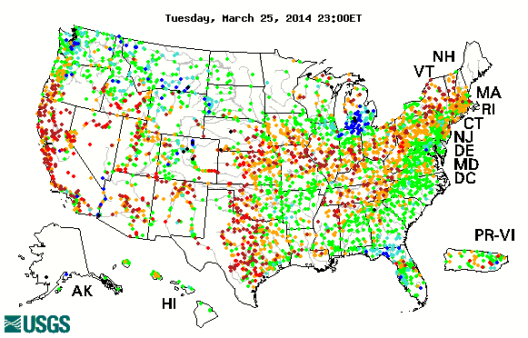
USGS WaterWatch for Realtime Streamflow Data:
WaterWatch is a U.S. Geological Survey (USGS) World Wide Web site that displays maps, graphs, and tables describing real-time, recent, and past streamflow conditions for the United States. The real-time information generally is updated on an hourly basis. WaterWatch provides streamgage-based maps that show the location of more than 3,000 long-term (30 years or more) USGS streamgages; use colors to represent streamflow conditions compared to historical streamflow; feature a point-and-click interface allowing users to retrieve graphs of stream stage (water elevation) and flow; and highlight locations where extreme hydrologic events, such as floods and droughts, are occurring.
Millennium Ecosystem Assessment Report
Guide to the Millennium Assessment Reports
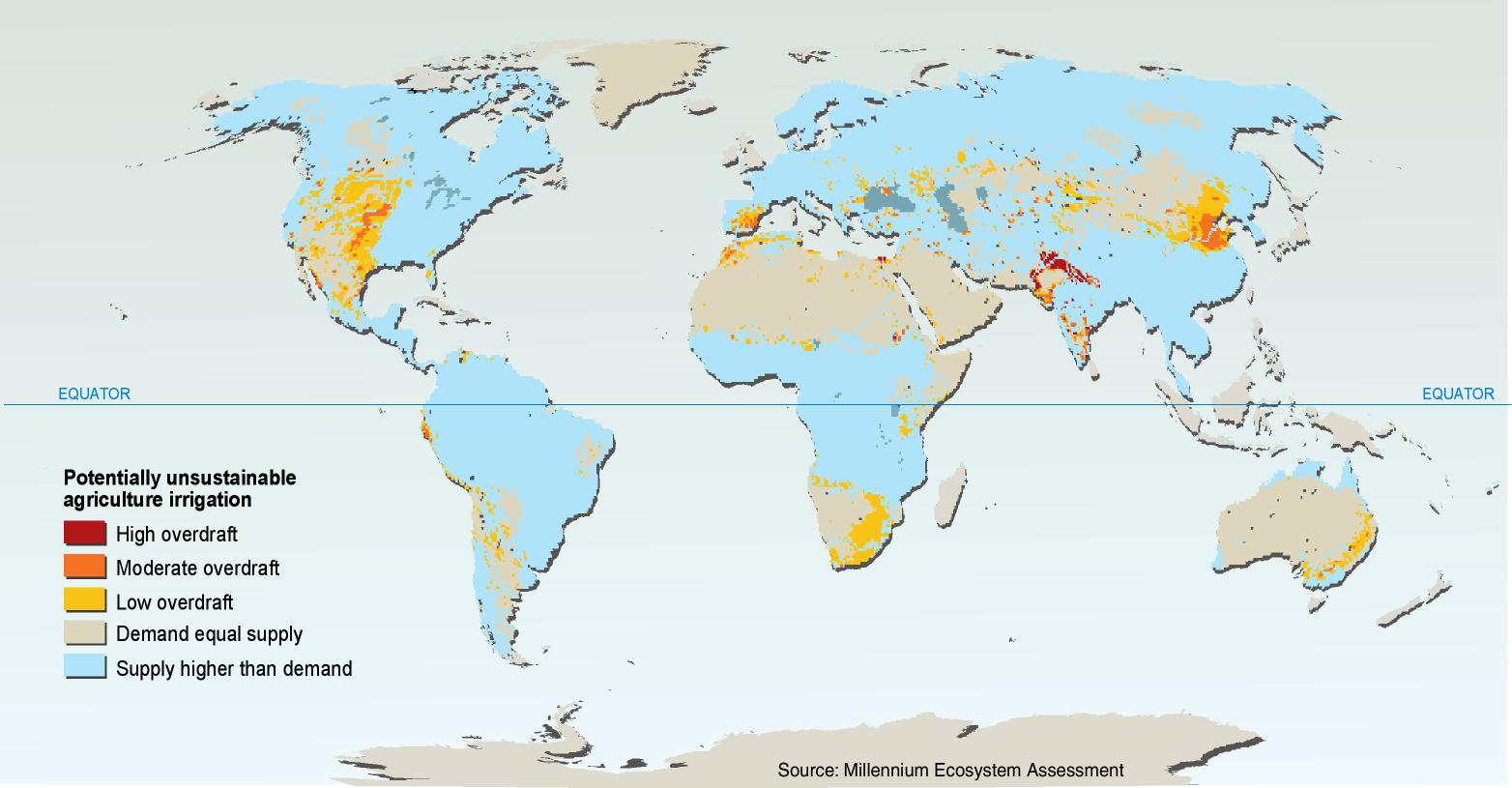
Millennium Ecosystem Assessment Report:
The Millennium Ecosystem Assessment assessed the consequences of ecosystem change for human well-being. From 2001 to 2005, the MA involved the work of more than 1,360 experts worldwide. Their findings provide a state-of-the-art scientific appraisal of the condition and trends in the world’s ecosystems and the services they provide, as well as the scientific basis for action to conserve and use them sustainably.
Intergovernmental Panel on Climate Change
Preparations for the Fifth Assessment Report (AR5) enter final stage
Intergovernmental Panel on Climate Change:
The Fifth Assessment Report (AR5) will provide an update of knowledge on the scientific, technical and socio-economic aspects of climate change. It will be composed of three working group reports and a Synthesis Report (SYR).
International Geosphere-Biosphere Program
Science of a sustainable planet
International Geosphere-Biosphere Program:
IGBP was launched in 1987 to coordinate international research on global-scale and regional-scale interactions between Earth's biological, chemical and physical processes and their interactions with human systems. IGBP views the Earth system as the Earth's natural physical, chemical and biological cycles and processes AND the social and economic dimensions.
Opentopography Project
A Portal to High-Resolution Topography Data and Tools
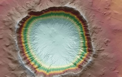
Opentopography Project:
The OpenTopography Facility is based at the San Diego Supercomputer Center at the University of California, San Diego and is operated in collaboration with colleagues in the School of Earth and Space Exploration at Arizona State University.
Shuttle Radar Topography Mission
The Mission to Map the World
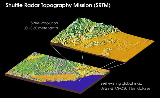
Shuttle Radar Topography Mission:
The Shuttle Radar Topography Mission (SRTM) obtained elevation data on a near-global scale to generate the most complete high-resolution digital topographic database of Earth. SRTM consisted of a specially modified radar system that flew onboard the Space Shuttle Endeavour during an 11-day mission in February of 2000.
USGS EROS Data Center
Providing science and imagery to better understand our Earth
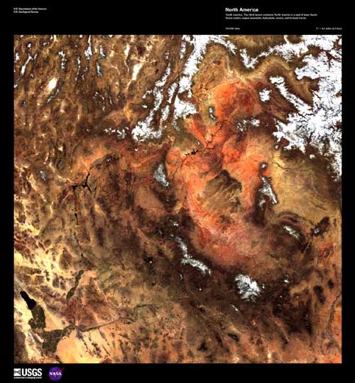
USGS EROS Data Center:
Earth Resources Observation and Science (EROS) Center is a remotely sensed data management, systems development, and research field center for the U.S. Geological Survey's (USGS) Climate and Land Use Change Mission Area.
AmeriFlux Network
Research Network of the Americas
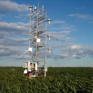
AmeriFlux Network:
The AmeriFlux Network ensures the availability of the continuous, long-term ecosystem measurements necessary to build effective models and multisite syntheses, while maximizing insight through robust, site-specific, independent research programs. With these consistent, high-quality environmental measurements, AmeriFlux helps ensure that critical decisions are supported by the most complete understanding and data.